HOME
The Rockpile. (see photo, see map) From Dong Ha you can travel down Highway 9 in I Corps all the way to the Laotian border at Lao Bao. It is a truly spectacular and historic drive. Highway 9 runs parallel just a bit south of the old DMZ. In that short stretch between Dong Ha on the east and the Lang Vei Special Forces camp at the Laotian border on the west exists a great deal of history concerning America's involvement. Although alot of the sites were originally SF camps, this area became largely Marine territory and sites like Con Thien, Khe Sanh, Mutter's Ridge, Camp Carrol, the McNamara Line, among others, occupy this relatively small area. One of the most spectacular sites of this area is karst-like mountain formation pushed up from the surrounding ground. The Vietnamese name is Thon Khe Tri but to the Americans it became the Rockpile. It sits approximately half-way between Dong Ha and Khe Sanh beside Highway 9. The summit commands a spectacular view of the surrounding area for miles. The importance of this view was not lost on the U.S. Military and the Marines established a tiny base on top, supplied and accessed only by helicopter. We were going to try and find a way up by foot.
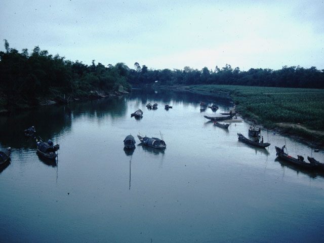
As you drive west from Dong Ha down Highway 9, the surrounding countryside is relatively flat and rolling. Running parallel and just to the north of Highway 9 is the Cam Lo River. Approximately 3-1/2 miles west of Dong Ha is the location of another interesting story from the war. Along this part of the river as it starts to bend northwest near the village of Thon Moc Duc is the area from which Navy Seal Lieutenant Thomas Norris and a Vietnamese Seal disguised themselves as fishermen and made their way west up the Cam Lo River on a sampan looking for a downed pilot, LTC Iceal Hambelton. The whole incident was made famous by the book and movie titled after Hambelton's call sign, Bat 21. Personally I thought the movie was crap but once you read up on the true story you may find we are in agreement. In any event, Norris would be awarded the Congressional Medal of Honor. (see map) Of course, we only knew of the general location for Norris' launch and we slowed the car down to just look at the river flow by and wonder what it must have been like that evening in April 1972 in the midst of the Easter Offensive by the NVA. The area was completely controlled and overrun by NVA troops and armor when Norris and his Vietnamese partner set off. At their launch point the river is quite close to the road and then as you travel on the road moves on westernly as the river moves to the north. Norris traveled by sampan at night up the river and found Hambelton just before the location of the Cam Lo bridge. We took a slight detour off Highway 9 and drove the mile or so to the bridge. Standing on the bridge and looking east about two or three hundred meters is where Norris found Hambelton. This was an interesting little side trip. To stand there and look over an area where an incredible incident had occurred unknown to every person standing around you. Obviously there is no marker or monument. We got back in the car and continued on to the Rockpile. To be continued. . ..